A peek inside a new book by Michael Van Valkenburgh Associates
Brooklyn Bridge Park in Photos
John Hill
1. February 2024
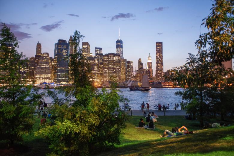
Photo: Julienne Schaer; all photographs are courtesy of Monacelli Press
Brooklyn Bridge Park is a new visual biography about the namesake, 1.3-mile (2-km) long park on the Brooklyn waterfront. Designed by Michael Van Valkenburgh Associates (MVVA), the park is immensely popular for its views of Lower Manhattan, mix of active and passive uses, and beautiful landscapes built on former industrial piers.
Brooklyn Bridge Park, published by Monacelli Press this week, is hardly the first book about Brooklyn Bridge Park, which was conceived in 1999 and formally completed in 2021. Back in 2016, two books were released, each one written by women with firsthand knowledge of the complex process of turning the forlorn yet prime site into a park, not into parcels for commercial and residential development: Nancy Webster, executive director at the Brooklyn Bridge Park Conservancy, wrote (with journalist David Shirley) A History of Brooklyn Bridge Park; and Joanne Witty, vice-chair of the Brooklyn Bridge Park Development Corporation, wrote (with writer Henrik Krogius) Brooklyn Bridge Park: A Dying Waterfront Transformed. Whereas these two books documented the how and why of the park that had partially opened in 2010 but was still five years away from completion when they were released, the new book edited by MVVA focuses on the what: the design of the landscapes that make up the majority of the park's 85 acres (34 ha). And unlike the academic texts of the earlier books, the MVVA book is conversational in its verbal illumination of the park's many design features. But, first and foremost, it is a book of photographs, a visual celebration of a park a quarter-century in the making. Below is a visual tour through Brooklyn Bridge Park — the book and the park.
Although Brooklyn Bridge Park has six entry points from the adjacent neighborhoods of Brooklyn Heights and Dumbo (and a few lesser-used access points from the East River), this tour moves from south to north, starting at Pier 6, whose “uplands” (meaning on-grade, not on the piers in the river) are home to numerous playgrounds: “a spectrum of spaces to serve different personalities and play styles,” per MVVA. (Photo: Elizabeth Felicella)
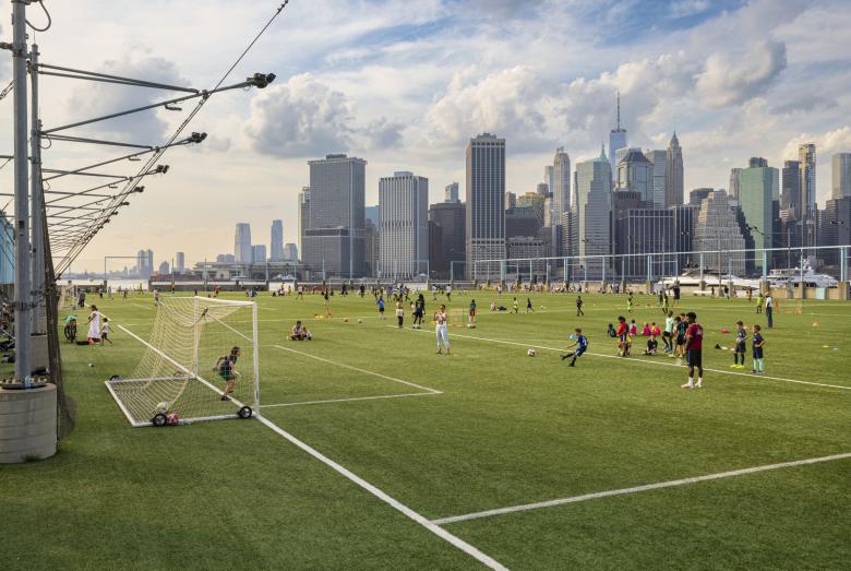
Next is Pier 5, which is covered in artificial turf for soccer and other sports. Recognizing that many people will stay near the entries to the park rather than venture along its mile-plus length, MVVA placed destinations, such as sports activities, at piers at a remove from the park entrances. (Photo: Etienne Frossard)
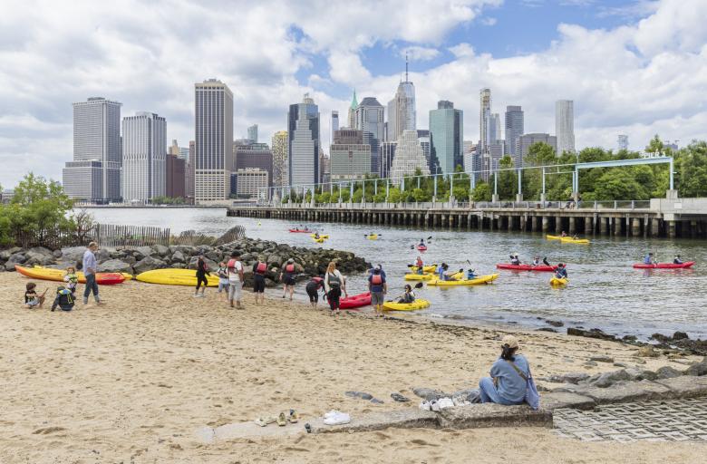
Pier 4 had sunk into the East River well before park construction commenced, but a remnant of it adjacent to the Greenway — a wide walkway for pedestrians and bicyclists that connects the piers — was reused for Pier 4 Beach, which is home to a kayak launch in warm months. (Photo: Etienne Frossard)
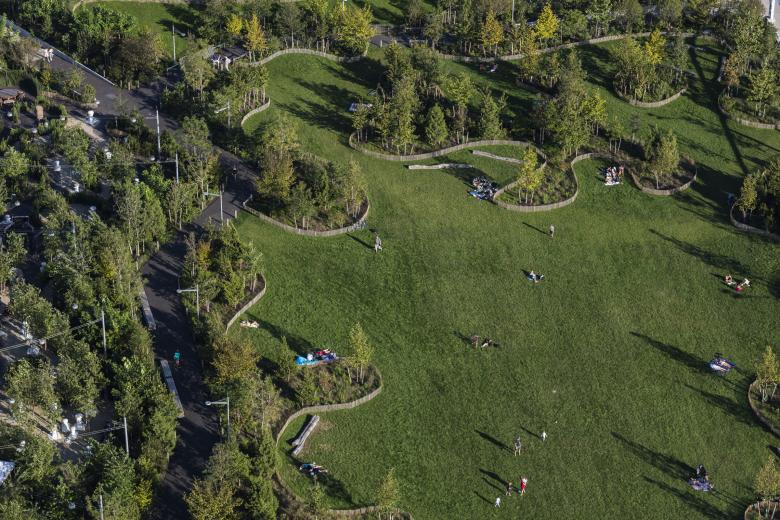
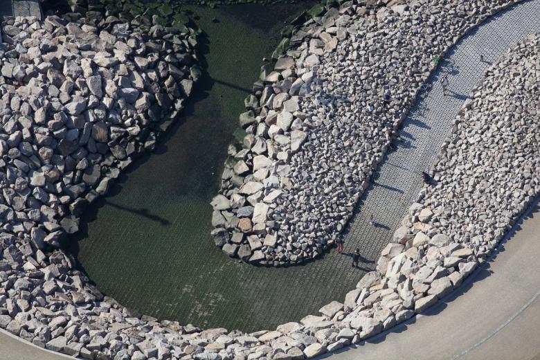
Is this an aerial of Central Park? No, it's the Central Lawn on Pier 3, the last major pier landscape at Brooklyn Bridge Park, completed in 2018. (Photo: Alex MacLean)
Lawns are rare in the five boroughs, so their provision in a public park automatically makes them popular. The appeal of Pier 3's Central Lawn is heightened by the views of Lower Manhattan. (Photo: Etienne Frossard)
Making the Central Lawn more enjoyable to people are Pier 3's perimeter trees and plantings, which shield people from the chilling harbor breezes. (Photo: Elizabeth Felicella)
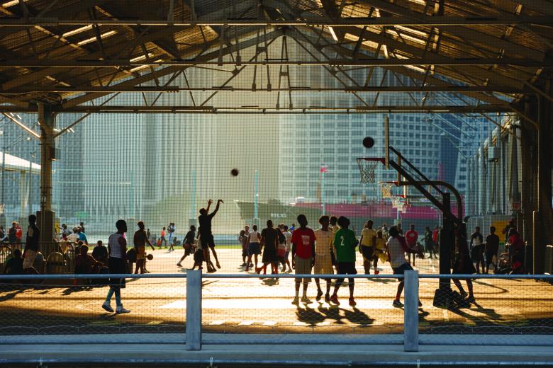
Pier 2, whose partial roofs resemble the cargo piers that served this swath of the Brooklyn waterfront last century, is another destination at a remove from a park entrance, complete with basketball courts and other sports venues. (Photo: Scott Shigley)
“The water's edge was invigorated with a mix of preserved industrial structures, naturalized edges, and stabilized embankments,” per MVVA, including the Spiral Pool by Pier 2. Granite salvaged from the reconstruction of NYC bridges further up the East River was used here and in other parts of the park. (Photo: Alex Maclean)
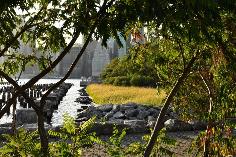
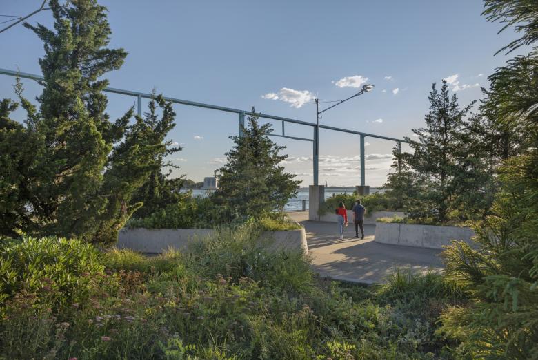
Flood protection measures can be seen throughout the park, including the Salt Marsh and Pile Field at the southern edge of Pier 1, where a portion of the former concrete pier was demolished to create a soft edge. (Photo: Izabela Levy)
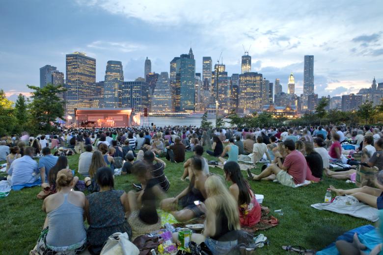
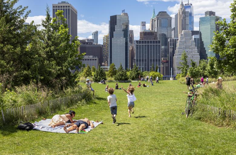
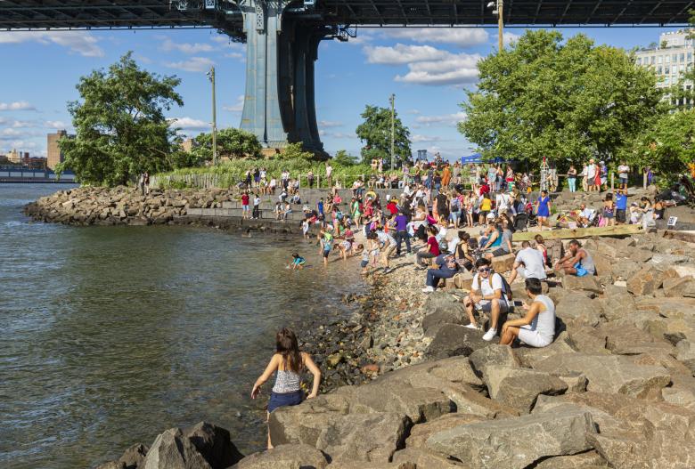
Pier 1 was one of the first parts of the park to open, in 2010, and it has remained the most popular place in the park, thanks to its central location, the stunning skyline views, and the mix of activities that the landscape's artificial topography allows. (Photo: Alexa Hoyer)
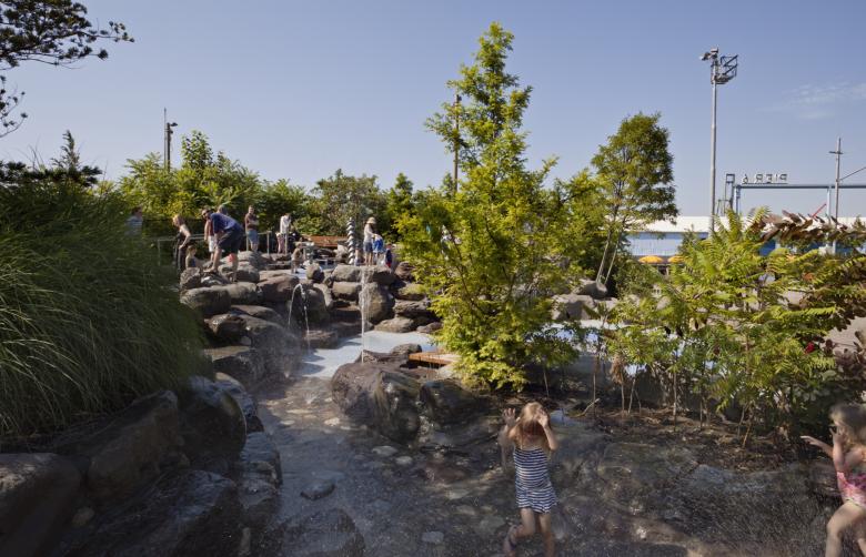
Are we in Brooklyn anymore? Four entrances to Pier 1 cross the Freshwater Wetlands, a 650-foot (198-m) long “series of gravity-fed aquatic cells, including three ponds, threaded together by a densely planted rivulet.” The wetlands, per MVVA, “are home to an astonishing variety of creatures,” from insects and birds to bats and turtles. (Photo: Elizabeth Felicella)
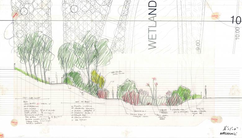
The book is not all photographs, as this sketch of the Freshwater Wetlands attests. Note the two levels of walkways between the Greenway at left and Pier 1 at right. (Drawing: MVVA)
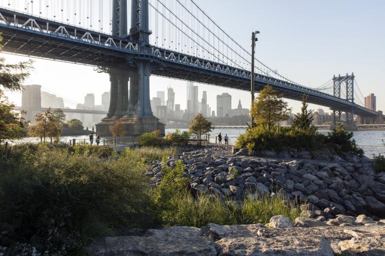
While the bulk of the book presents the handful of piers south of the Brooklyn Bridge, the park continues past it and the Manhattan Bridge, where parts of the waterfront were transformed into parkland in earlier years. Still, MVVA contributed pieces such as the Pebble Beach at Main Street Park, a popular spot between the two bridges. (Photo: Etienne Frossard)
This last photograph shows the tidal inlet at John Street, the northernmost section of Brooklyn Bridge Park. It is one of a few salt marshes in the park, created by MVVA “to reestablish a measure of the site's original biodiversity and environmental resilience in a way that would be restorative for people, too.” (Photo: Elizabeth Felicella)
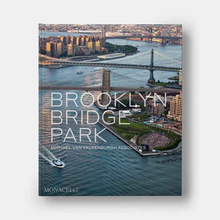
Brooklyn Bridge Park: Michael Van Valkenburgh Associates
Edited by Michael Van Valkenburgh and Elijah Chilton
With a foreword by Julie Bargmann and an afterword by Amanda Hesser
305 × 254 mm (12 1/64 × 10 in)
304 Pages
250 Illustrations
Hardcover
ISBN 9781580936170
Monacelli Press
Purchase this book